There’s always time for a cave adventure

The cave we were exploring made a sharp turn to the left and narrowed so that we had to crawl through this new passage. We continued down it, my son going first. Soon we came to a room large enough to stand up in. My son went in and, just as I was about to enter, he turned around and began crawling out crying, ” Quick! Turn around!”

Earlier that day my oldest son and I met in the kitchen, each looking for something eat. We realized that we were both home for the rest of the day; me with a day off from work and he had finished a final at school and was home early. The December day, which had started off with bright blue skies, was now gray but fairly warm. We decided then and there that it was time for a mini adventure, so we did a quick wardrobe change and 10 minutes later we were off in search of a couple caves we had heard about.

Continue reading “There’s always time for a cave adventure”

The loneliest spot on earth

“Mono Lake lies in a lifeless, treeless, hideous desert, eight thousand feet above the level of the sea, and is guarded by mountains two thousand feet higher, whose summits are always clothed in clouds. This solemn, silent, sail-less sea–this lonely tenant of the loneliest spot on earth –is little graced with the picturesque. “

– Mark Twain

My first glimpse of Mono Lake was late at night. We had just driven up and over Sonora Pass, which had opened for the season a few days earlier. The road had been descending out of the snow covered mountains for quiet awhile when I caught a glimmer out of the corner of my eye. I glanced out of the window and saw nothing but thick darkness. A few minutes later we rounded a bend and there far below us was a glistening moonlit lake. The road continued down and ran alongside the lake. From this viewpoint the lake seemed to go on forever and it was impossible to tell where it began or ended. Then we rounded another curve and it was gone and we were left to stare into the inky blackness of night.

A few days later we made it back to Mono Lake, this time in daylight. Even in the light, we still felt a moment of surprise to round a corner and come upon the lake. A shimmering mirage in the middle of a dry, dusty landscape.

Continue reading “The loneliest spot on earth”

The underwater ghost town

Tennessee is a beautiful state with amazing state parks. Parks that range from high mountain peaks to the Mississippi delta, from battle fields to Native American burial grounds, from gorgeous blue lakes to diverse river systems. There’s just so much beauty and variety. So, I’ve made it a goal of mine to visit every state park in Tennessee in 2018. Below is my story of my adventure at one park.

I stood high on a hill overlooking a vast expanse of water far below me. The lake, glistening blue in the late afternoon sun, was empty save one man fishing from a boat in a shallow cove. All was quiet and tranquil; a picture-perfect spring day at the lake. But this would have been a much different view some 80 years ago, before everything changed.

Continue reading “The underwater ghost town”

In search of frozen waterfalls

I stood on a narrow strip of ground and looked at the ice beneath my feet. The ravine was deep here. On one side of me was the creek, snow and ice covered cliffs on the other. I gingerly stepped forward and began to slip. Inhaling sharply, I grabbed at the rock next to me only to get a handful of icicle. “Mom!”, came a yell from behind me and I realized that the kids had followed even though I had told them to wait while I checked things out first. “Well, were all in this together now”, I thought and continued to gingerly make my way forward.

Continue reading “In search of frozen waterfalls”

The secret of Old Stone Fort State Park

Early American hunters and traders traveling ancient, well-trodden paths in what is now Middle Tennessee, came upon a stone structure built on a peninsula created by the confluence of two rivers. Rock and earthen 4-6 foot high walls boarded the entire peninsula. This “old stone fort”, as they believed it to be, sat high on bluffs carved out by fast moving rivers and was protected by a moat on one side. They wondered who had built the impressive structure; thinking perhaps it was Buccaneers or Vikings or some other group of early Europeans, but no one knew for sure. The answer, when it was learned, shocked everyone.

January 1st, 2018. Everything always seems so new and fresh and hopeful on January first, as though anything’s possible. I like to start the year with an adventure, hoping it will set the tone for the rest of the year. So, each year, our family does a First Day Hike. State Parks across the country offer these ranger-led hikes as a way to get out, explore, and start the new year right. This year we chose Old Stone Fort State Park.

The day was bitterly cold; wind-chills hovering in the single digits. Usually our entire family goes, but this year because of some sick kids and husband, only my 16 year old son and I ventured out. I bundled up- long underwear, multiple layers of clothes, wool socks, hat, two pair of gloves, face mask, boots, and hand warmers- so that when I was finished, only my nose was showing. My son threw on a fleece, hat, and gloves because he “doesn’t get cold”, and we were off.

I had often passed the brown signs on the highway for Old Stone Fort State Park, but this was our first time at the park. We arrived and went into the museum where I was surprised to see so many people waiting to go on the hike on such a cold day. We all signed in, finished putting on hats and gloves and scarfs and boots, met the ranger, and were off, back into the cold. There ended up being 41 people and 1 dog on the hike which made me happy to see that so many others liked the tradition as much as we did, cold and all!

The hike was a 3 mile loop that followed the rivers. The peninsula that the park is created around is formed by the confluence of the Duck River and Little Duck River. This river system spills over a shelf in the Cumberland Plateau known as the Highland Rim and rapidly drops in elevation as they approach their convergence. This has led to deep gorges cut in the limestone around the peninsula. There are a series many rapids and waterfalls, one of which was our first stop. This was the site of one of a few mills and factories that were built along the river in the 1800s, harnessing the Duck River’s power. We all took picture as the biting wind blew off the water, and then quickly moved along.

The hike continued, heading down now out of the wind, to the fork of the Duck and Little Duck River. We turned to now follow the Little Duck River whose banks were edged with ice as were rocks protruding from the middle of the river. Yet it was a beautiful location. High bluffs behind the river gave privacy to the boulder and tree lined river. It was the perfect spot to wile away a warm summer day- hammock strung between two trees, fishing, napping, and enjoying the peaceful sounds of the river and forest. But not on January 1st! My son and I vowed to come back in the summer!

The Little Duck turns sharply here, forming a horseshoe. We followed it until we came to the base of a narrow ridge. The trail turned and we began to climb away from the river up the spine of the ridge. We could now see why the trail we were on is named Backbone Trail. We hiked along the narrow ridge, the river far below us on both sides. Then it was back down the spine.

Back in the bottom of the forest again, we reached the Moat Trail; a narrow flat open section. This was where early settlers thought the ancient moat that protected the fort was located. But it never was a moat at all! Our ranger told us that they actually think the Little Duck River once flowed here before, at some point, it rerouted to where it is now. We followed the moat/riverbed for awhile and then the trail turned and climbed sharply. This is the steepest section of the trail, heading up and out back to the Old Stone Fort high on the peninsula. The trail continued with the open grassy area that was the supposed fort on our left and the river flowing through rapids and more waterfalls far below us on the right.

And then we learned the truth! This was not an old stone fort as was once thought, but rather an ancient ceremonial site dating back to 30-430AD. Native Americans, not Europeans, had built this gradually over several hundred years. This was before the tribes of Native Americans that we know today even existed. It is thought that no one ever lived here, but would journey to the location for ceremonies. They have found that the sun rises perfectly down the center of the path into the site during the Summer Solstice. A very sophisticated design well before it was thought there were sophisticated people in the United States! Now a great state park with a completely misleading name!

You can learn more about the park here. Go and visit it, you won’t be disappointed!

To all who love a road trip

To anyone who has gone on a road trip or longs to do so:

It’s dark out as you pull your car onto your street.  You pass by neighbor’s blackened windows wishing, for a second, that you too are still in bed fast asleep.  But then you think of what lies ahead.  You remember the road trip and all thoughts of sleep vanish.  You reach for your coffee and punch the gas. Continue reading “To all who love a road trip”

Our favorite hike in Arkansas: the Lost Valley Trail

The cool, rainy morning was a relief after a number of brutally hot and humid days.  Not that the heat and humidity should have surprised us, this was Arkansas after all.  

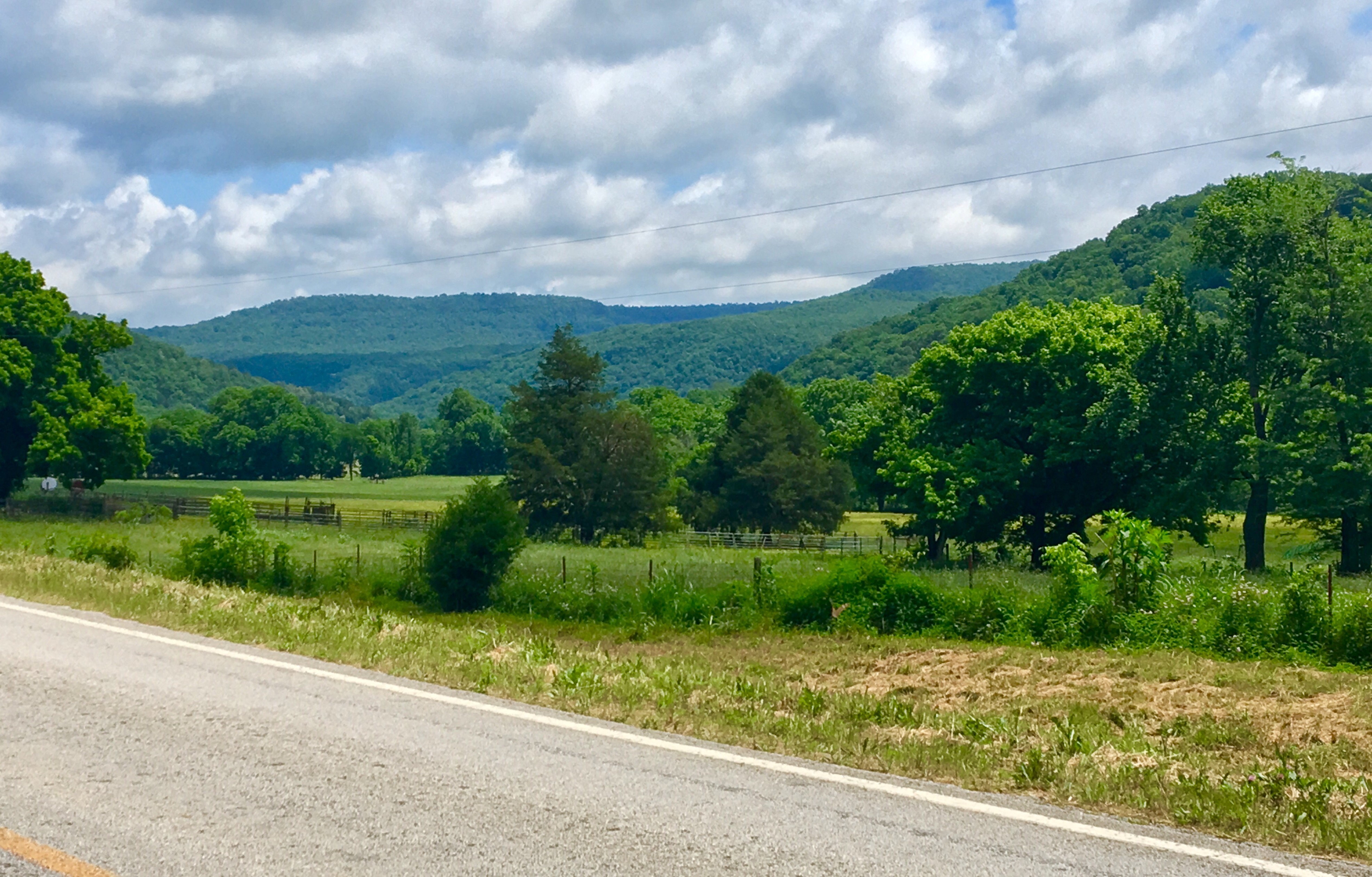
We had come to the Ozark Mountains for a long weekend of hiking and exploring.  Crossing the Mississippi River in Memphis, we immediately hit the flat, fertile flood planes of Arkansas.  Rice paddies (who knew?!!) stretched out in front of us for miles and it was a long time before we entered the hills of the Ozark Mountains.  Fields gave way to pines and the small towns grew further apart.  The road curved sharply, climbing higher as we passed vacation homes clinging to the sides of the mountains.  


We stopped for gas at a station with an amazing view and a dog blocking the entrance of the store.  He raised his head and looked at us with half open eyes as we entered, but did not move.  The two women behind the counter, excited, it seemed, to have a customer, told us of a hidden waterfall nearby that they had just explored.  The waterfall sounded great, but we had to keep moving.  We reached our hotel just as storms rolled in and watched the rain fall in sheets from the dry safety of our room.

The rain stopped mid-morning the next day as we drove through rolling farmland.  A misty fog clung to the hills as we passed dirt roads leading to small farms set among fields filled with cows.   It seemed hard to believe that there was a hike set among the farms, but soon we entered a lush hollow and saw the sign for the trailhead named, appropriately, Lost Valley Trail.

Lost Valley Trail, located within Lost Valley State Park, is a great hike that at just 2.2 miles R/T is accessible to anyone.  It’s a popular hike, so the trail is often crowded.  But the great thing about the hike, the reason we decided it was our favorite, is that it is so varied.  There is just so much to explore on this short hike.

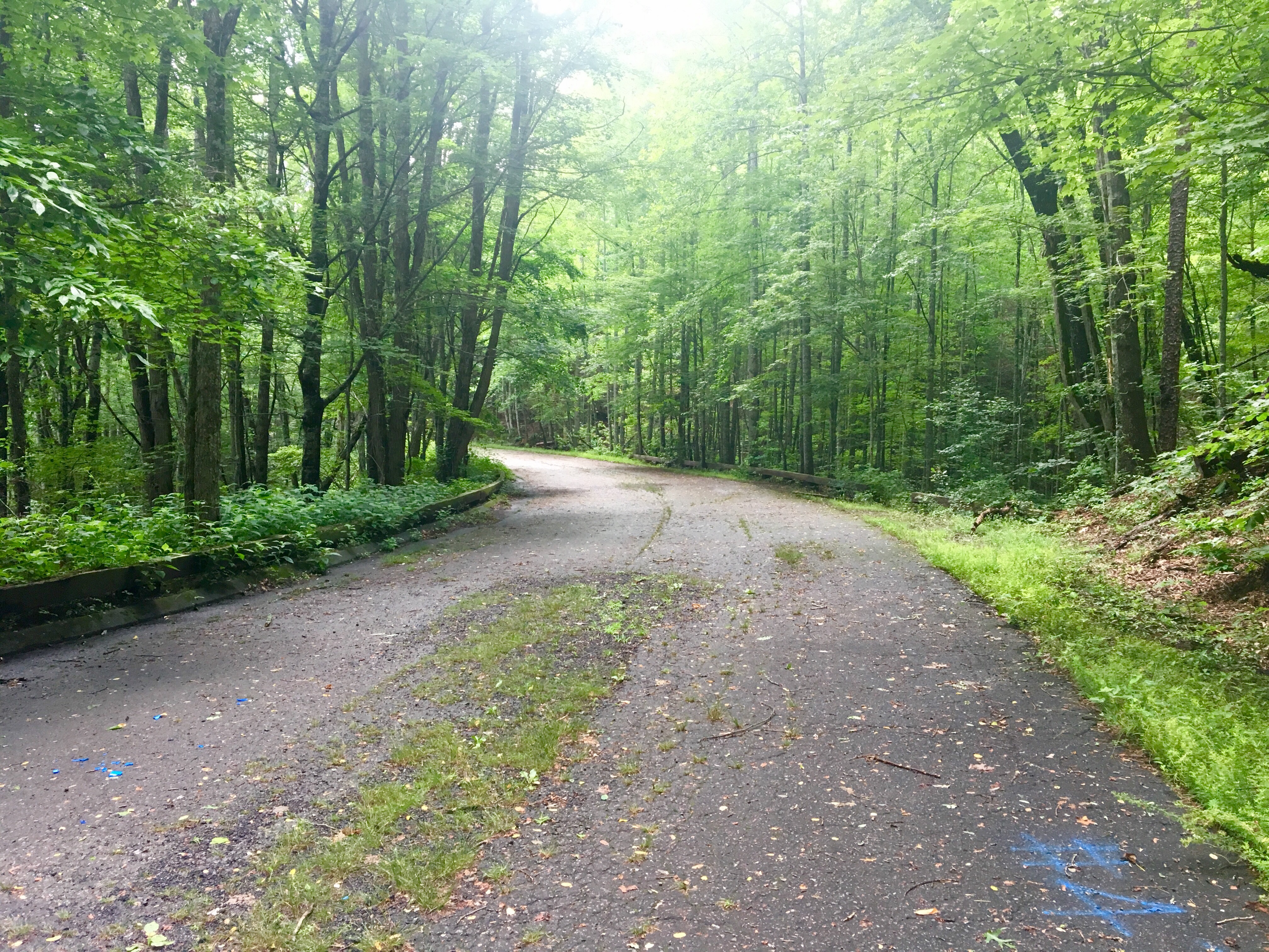
The first half mile or so of the trail is flat and handicap accessible.  There are even a few benches to sit and rest and enjoy the cool quiet of a hardwood forest and the Clark Creek.  After that the trail becomes less level and starts to climb some.

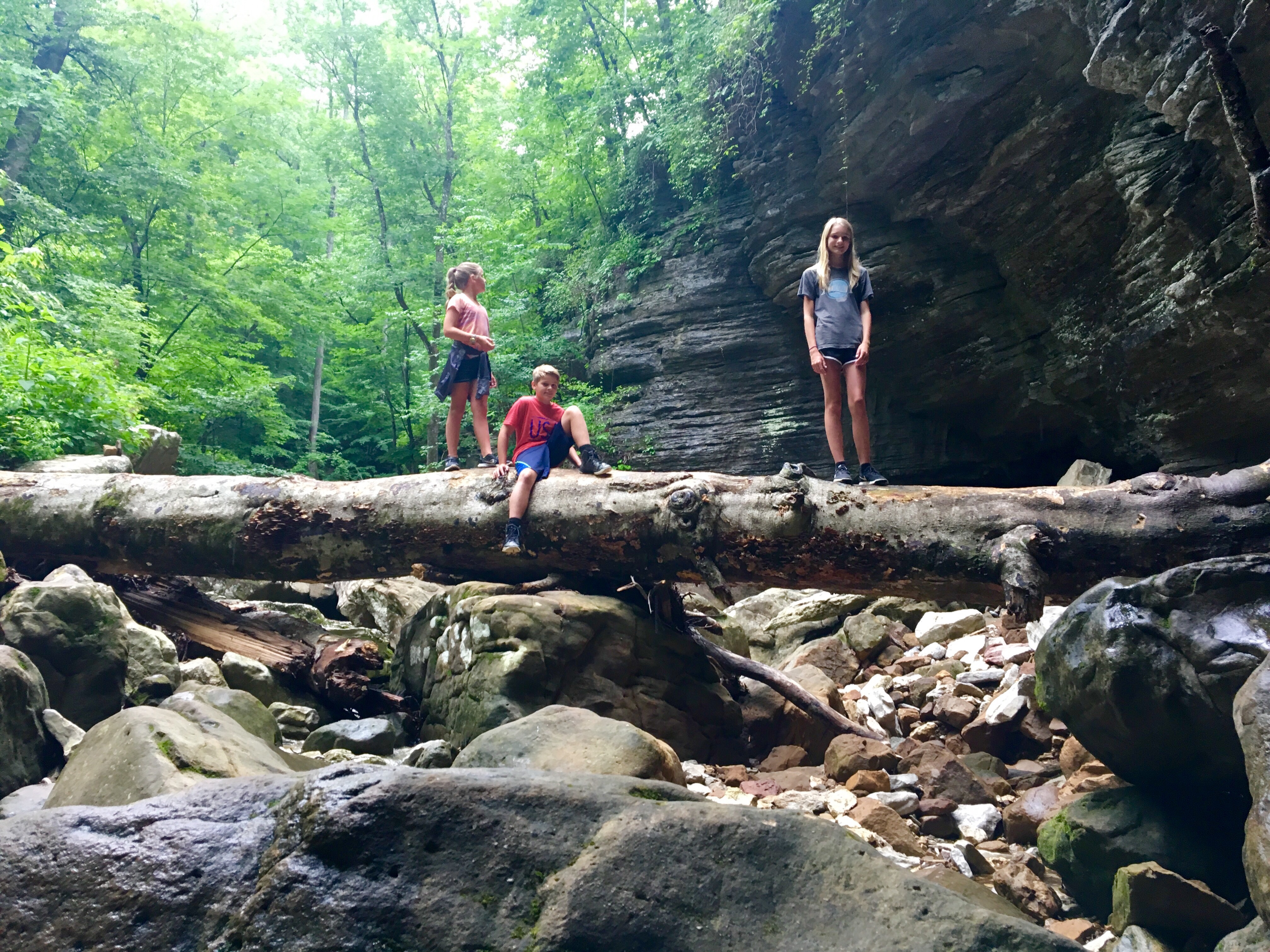
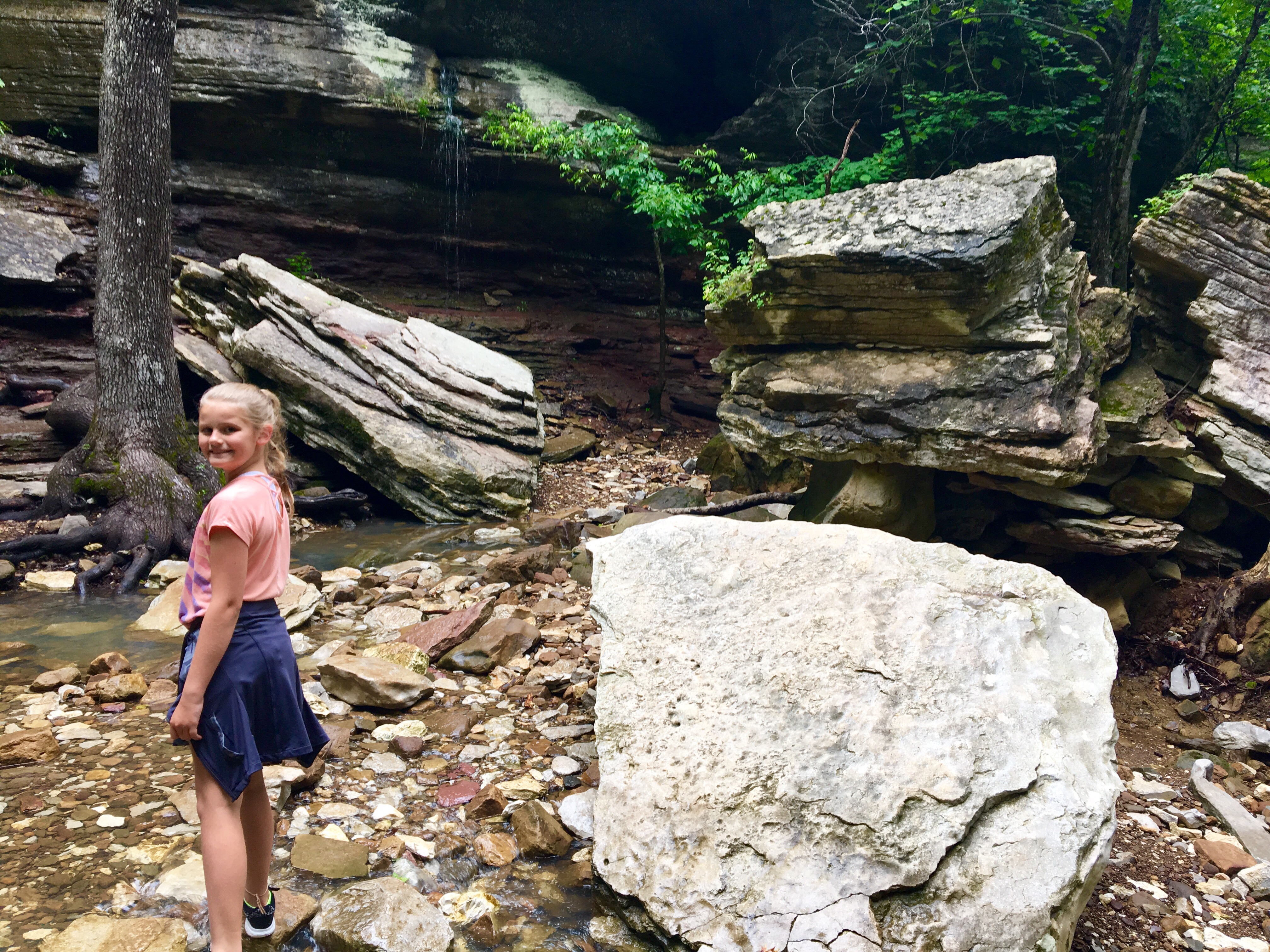
The entire hike is through a box canyon which might have once all been underground.  High bluffs surrounded us on both sides.  Many of the feature on the trail point to this, such as our first stop to look at massive stone blocks that fell long ago from the surrounding bluffs.


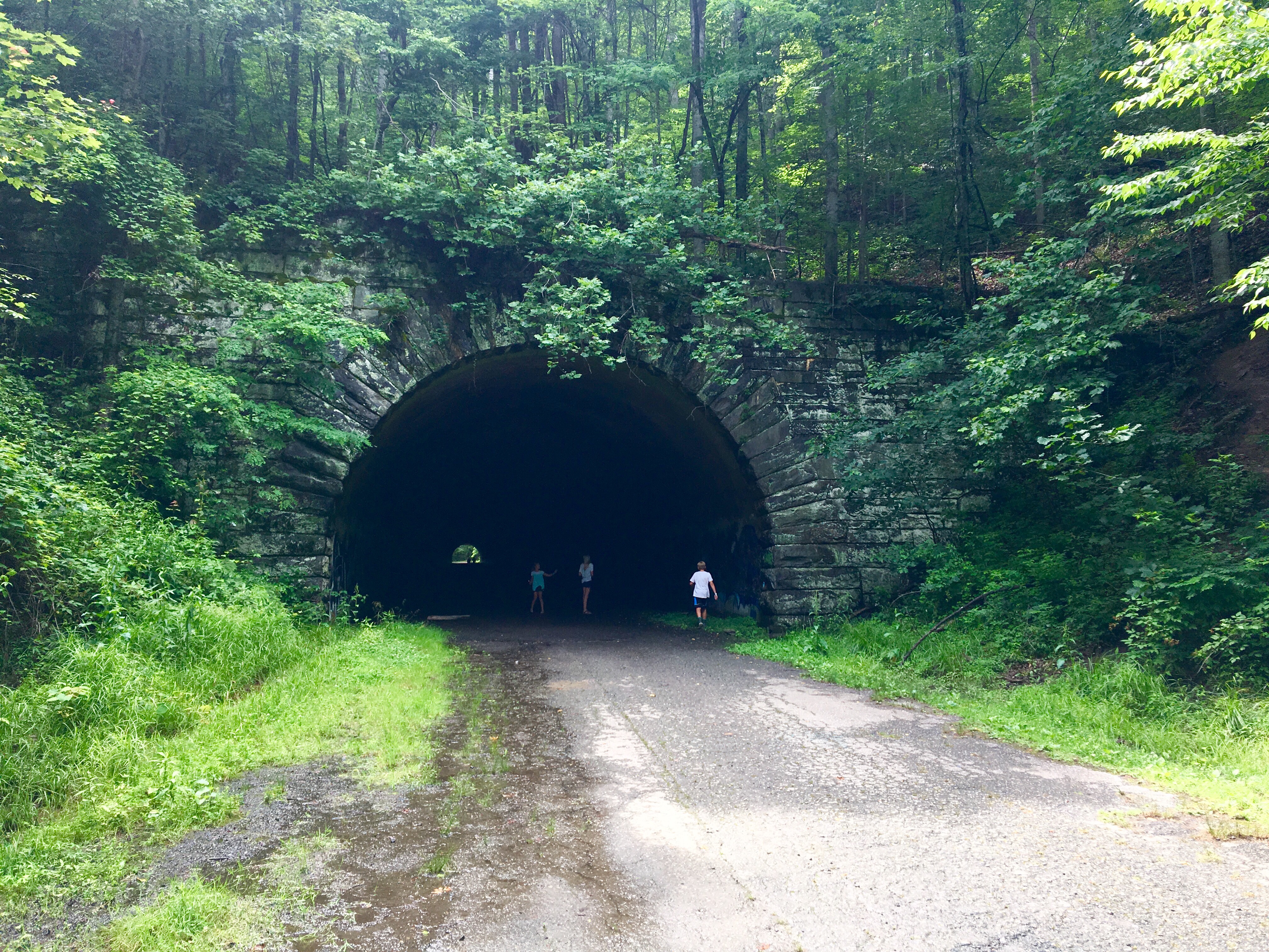
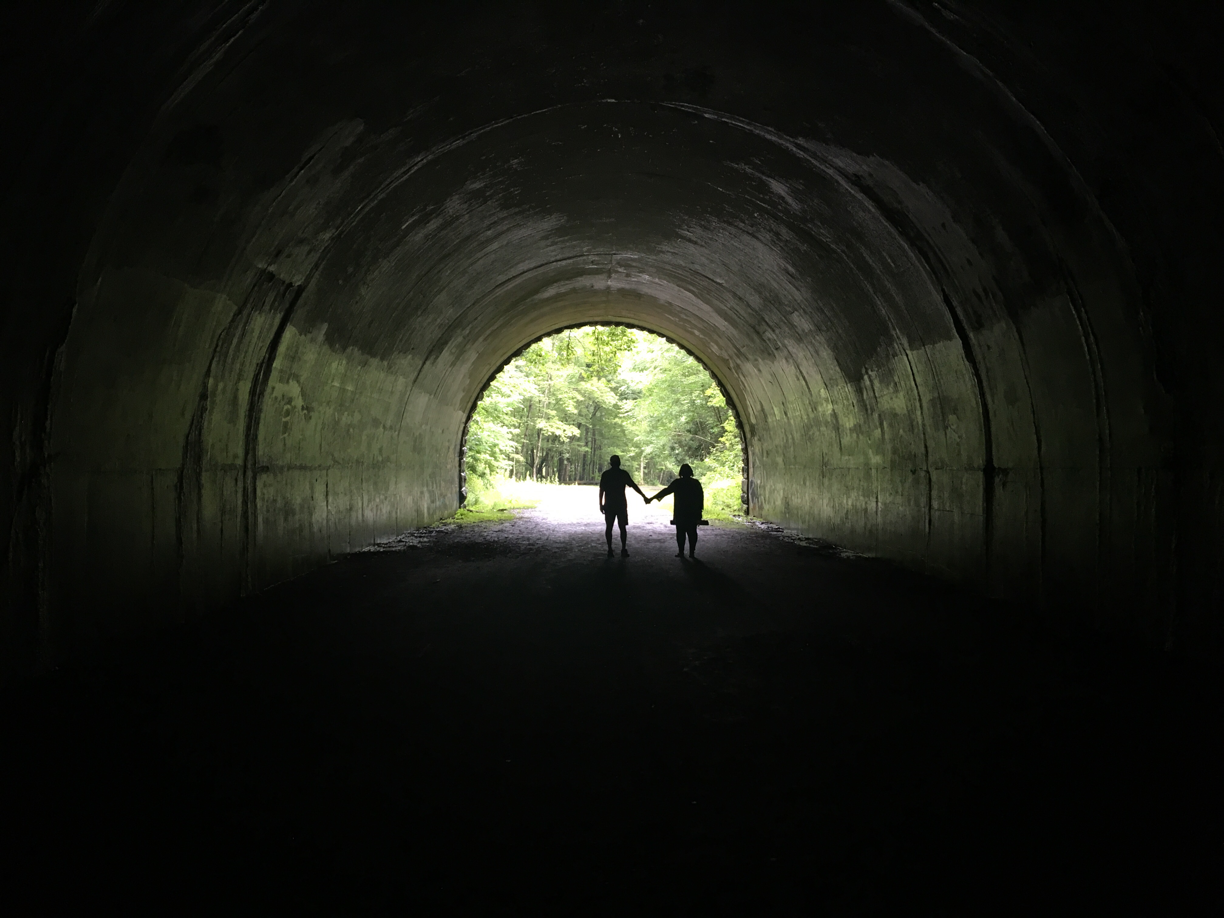
We hiked some more and soon came to a natural bridge.  Here the creek has carved through limestone to create an arch.  The water was low enough that we were able to climb through the “tunnel”.  The sun came out, rapidly burning off the remaining fog and the day started to heat up, so we stopped to rock hop and play in the creek. 

Our next stop on the hike was Cob Cave.   It’s not actually a cave, but rather a giant bluff shelter once used by Native Americans that gets its name from corn cobbs found on site.  We spent some time exploring the cave and marveling at the sheer size of it.  It was easy to imagine this being used as a shelter and place to stop and rest for the night.


Stop number four on the hike was Eden Falls.  It’s a series of four waterfalls that plummets 170 feet down the bluffs.  The hike brought us to the base of the falls and then turned to steeply climb out, providing good views of the entire waterfall.


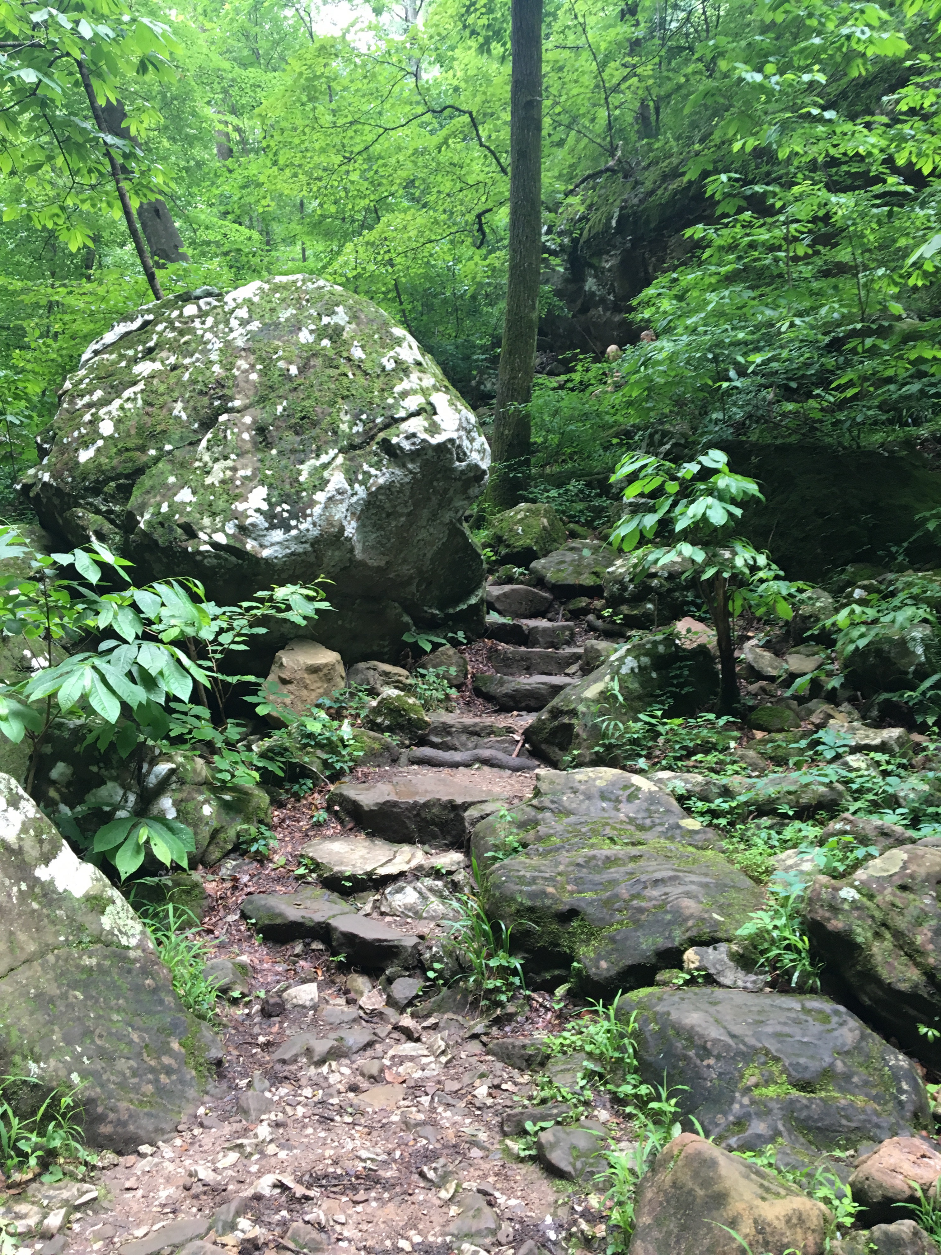
The trail climbed some more, up a set of mossy stone stairs.  They twisted around large boulders and disappeared into the green forest.  Water from last night’s storm still dripped down on us as we stared up at the canyon walls.  They surrounded us and made us feel very small.

Lost Valley.  Here, you could feel how the area got its name.  Standing quietly in the forest, you had a sense of timelessness.  Of the ancient hitting against the present; unchanged by time.  It was comforting to know a place like this still existed!


We hiked on, still climbing some until we reached the last stop of the hike; Eden Falls Cave.  Water from Clark Creek flowed out of the entrance to a small underground cave.  We crossed the creek and climbed up a ledge which the water flowed over, creating a small waterfall.  Peering inside the murkiness of the cave, we were excited.  It was time to go explore!

 The cave has been carved by the stream but there is still a good deal of dry land to walk on.  We strapped on our headlights and began to walk back into the darkness.  You definitely need a flashlight to explore the cave as it is very dark once inside.  We decided to head to the left and soon were on our hands and knees crawling because the ceiling of the cave was so low.  

After a couple minutes of crawling we reached a large room in which we could easily stand.  This is the waterfall room which is about 200 feet back from the entrance of the cave.  We could just make out the 35 foot falls through our headlights.  It was really neat to see a waterfall so deep in a wild cave. (I included a picture of it but it was difficult to get a good one with an iPhone in a dark cave!)


We turned to head out of the cave and realized that there was a narrow passage to our left that we could take that did not require us to crawl.  It was so much easier! So, if you don’t want to crawl, take the passage to the right when you first enter the cave.  You might need to stoop here and there, but will stay on your feet.

We exited the cave, blinking against the shock of bright sunlight after the darkness of the cave, and crossed back over the creek to the trail.  Eden Falls Cave is the end of the trail, so we headed back; a quick one mile hike out through the forest.  The cool solitude of the forest was enjoyable and before we knew it, we had reached our car.

This was a great little hike!  Definitely a must do if you’re ever in Arkansas.  I’ve included a link to the trail information and location below.  Have fun exploring!

Lost Valley Trail

the road to nowhere

Lakeside Drive.  It was a typical enough road, climbing out of downtown as it took us past a school and houses and farms.  Typical enough, at least, until we rounded a corner and saw the sign that let us know we were on the Road to Nowhere.

Fontana Lake is beautiful.  Mountains drop straight down to its’ tourquoise-green waters while fish jump and bald eagles fly overhead.  It twists and turns through 30 miles and is so remote that you rarely see another boat.  But, it’s what’s underneath the lake that is the most interesting.


In the 1940’s, WWII had finally reached America and an increase in aluminum was needed for wartime efforts.  The rugged and remote valley of the Little Tennessee River was chosen to create a dam to produce electricity for the ALCOA aluminum plant in Tennessee as well as for Oak Ridge National Laboratory’s Manhattan Project.  

The valley was filled with small towns.  People who had been there for generations, working in mines or for lumber companies.  People who loved the beauty and isolation of the area.  Old Highway 288 connected these communities to each other and to their cemeteries.  But, because of the war, things moved fast and, before they knew it, more than 1300 families were forced to leave the area.  The TVA built the dam, the tallest in the east, in a little over two years and Fontana Lake was formed, submerging the towns and Highway 288 far below.

The towns were gone but the Federal government promised to replace Highway 288 with a new road.  The road was to hug the north shore of Fontana Lake from Bryson City to Fontana, providing a way for the former residents to have access to the generations that remained behind in the old family cemeteries.

Construction began on Lakeview Drive in Bryson City.  The road entered the Great Smoky Mountain National Park and everything was going well until an environmental issue halted construction.  The issue was eventually resolved, but construction of the road never resumed.


The road now follows the lake about six miles into the park and abruptly ends at a tunnel.  It truly is a “Road to Nowhere”.   You can now park at the tunnel and hike through it.  Once through the tunnel, the asphalt ends and half finished guard rails give way to hiking trails that continue around the lake.  


 And the cemeteries still remain, more quiet and isolated than ever.  The only way to access them is by hiking in or taking a ferry that the Park Service offers during the summer so former residents can visit their ancestors.  One of the only reminders that this was once a valley filled with small towns bustling with activity.
Below is a map of the area.  You can reach the tunnel by taking Lakeview Dr. East (aka the Road to Nowhere) out of Bryson City.  The road ends at a parking area near the tunnel.

the most romantic picnic spot

It’s difficult to find a more beautiful place than the Smoky Mountains in June.  Spring’s lush green is everywhere.  Colorful wildflowers blanket the hillside.  The sun sets late, slipping slowly behind the mountains as lightening bugs flicker in the evening sky.  The heat and humidity of later months has yet to arrive.  And, best of all, the rhododendrons are in full bloom.


Catawba Rhododendrons, native to the Southern Appalachians, bloom in late-May at lower elevations and in mid-June higher up. The purple-pink bloom lasts only for a short time but is beautiful. One of the best places to view them is at the Roan Mountain Gardens on the North Carolina side of the NC/TN state line.  

Here you can wander through a naturally occurring rhododendron garden high up at an elevation of over 6000 feet. The main path is paved so it is accessible to most people. The bushes are dense and, when in bloom, make for a magical hike.


But the best part are the picnic areas. Tucked away in corners of the park are picnic areas. Moss covered tables nestled under pines and the rhodendrons. As the flowers fall they cover the ground creating a pink carpet. A fairytale setting for a romantic picnic!

You can find more information about Roan Mountain Gardens, including its exact location, here.


New discoveries of the old

looking into camp buildings

Most days I drive the streets of the county I live in thinking of the day’s activities, where we need to go, how late we are running.  Always in a hurry, I give little thought about the surroundings I know so well.  I drive the kids to school, drive around for work, take the kids to their activities, all the while passing homes and farms and buildings and stores without notice.  When we go to a new location my eyes are open taking everything in; it’s all so new and exciting.  “I wonder what that building was originally used for?” or “Where could that trail lead?” or “How old is that house and who might have lived there?”.  But here in my own county I know have seen it all, heard it all, I know the history and events of the area.  I take the kids to a park and they run around in the open field, climb around on the monkey bars, my son plays hockey with his friends, we have a snack on a picnic table without a thought to what might have been there.  I guess if I would think about it, perhaps the playground was once a farmer’s field or a wealthy homeowner’s  property deeded to the town.  But who has the time to wonder about the history of a playground, I need to gather the kids into the car and hurry home to  make dinner!

But, I do love history and this past weekend while searching online for some information about a different possible adventure to take the kids on, I discovered the history of that exact park!  The one mentioned above that I have been to numerous times, talking to other moms while our kids run around and have fun.  They play and laugh and run on the same property where, sixty-some years ago, different children met, only their reason was much more sinister. Continue reading “New discoveries of the old”